| Holderness Coast - United Kingdom |
| Complete description
of case study |
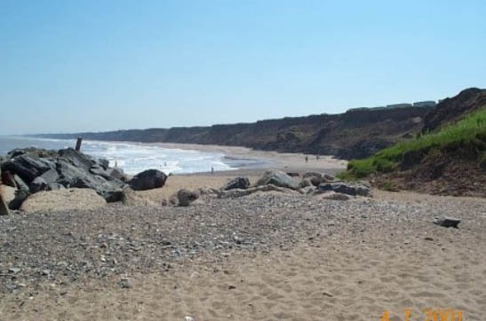
PHOTO OF THE SITE
 |
|
CASE STUDY
| Title | Holderness Coast |
| National level | United Kingdom |
| Regional level | Yorkshire |
ABSTRACT
|
The Holderness coast mainly consists of soft glacial drift cliffs, which have been cut back up to 200m over the last century. The coast is subject to the full force of the waves from the North Sea, with little attenuation before they reach the cliff line. The sea is continually able to reach the base of the cliff. Generally, the natural beaches of Holderness are almost always narrow and unable to stop wave erosion. The sea attempts to build up an equilibrium gradient by eroding these soft cliffs behind the beach, to which the strong waves have easy access. This inevitably means that some of the Holderness coast will be eroded in order to achieve a more efficient coastal shape. On average, the coastline of Holderness erodes at about 2m per year, mainly during storms and tidal surges. The impacts of coastal erosion on socio-economic aspects are: damage and loss of infrastructures, loss of property, loss of farmland, danger for tourism, damage to coastal protection. The effectiveness of the measures taken on the Holderness coast are variable, but in general hard measures are successful in stopping or at least slowing down the erosion locally. However, due to the use of hard measures, erosion has increased downdrift of them. In between the towns with a fixed coastline, bays seem to be developing due to this erosion. The sea defences seem to be creating artificial headlands because erosion continues on both sides. As time goes on, this could mean that the headlands (towns) become more and more exposed to the force of the waves, while the coast in between the headlands will erode more and more until a stable bay is formed. Human interference, such as sea defences, causes rapid erosion of the unprotected beaches and cliffs. To counter this, local and regional authorities are nowadays trying set up integrated coastal zone management programmes for the whole coastline. |
BASIC INFORMATION
| Coastal characteristics |
|
| Policy options | Hold the line, do nothing |
| Socio-economic activities | Tourism and recreation, urbanisation, fisheries and aquaculture, agriculture and forestry, industry, transport and energy, nature and conservation. |
| Engineering techniques | Timber groins, drains, seawall, revetments |
SOURCE
| Name | Paul
Sistermans Odelinde Nieuwenhuis |
| Institution | DHV group |
| Address | Laan
1914 nr.35, 3818 EX Amersfoort PO Box 219 3800 AE Amersfoort – The Netherlands |
| Telephone / fax | +31 (0)33 468 37 00 / +31 (0)33 468 37 48 |
| paul.sistermans@dhv.nl odelinde.nieuwenhuis@dhv.nl |