Complete
description of case study
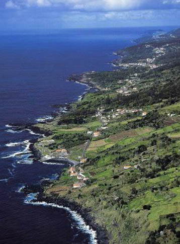
| Azores - Portugal |
Complete
description of case study |
PHOTO OF THE SITE
 |
|
CASE STUDY
| Title | Azores |
| National level | Portugal |
| Regional level | Regional Government of Azores |
| Local level | Azores Islands Municipalities |
ABSTRACT
|
This group is formed by nine islands, and their origin it is directly related with the tectonic movements of three plates, the African, the American and the Euroasia. The Azores is located in the microplate of Azores and demarks the frontier of these three plates. These islands have a volcanic origin, composed mostly by basalts, pillow and stone pumice. The volcanic episodes are recorded in all the islands, with the last big episode to happen in 1957-1958 in Faial, where the island increased 1 km lenght. The sea bathymetry is dominated by a very irregular submarine volcanic relief with abrupt slopes. These islands grown directly form the bottom of the ocean implanted in small plate. These islands don’t have continental platform that made the bottom of the ocean to vary quickly at a small distance from the coast line, from small depths to hundreds of metres. The inexistence of significant sandy beaches, dunes, sand spits and estuaries in Terceira island, means that its geological formation and geographic configuration do not promote great sand movements along the shoreline. However, there are significant mass movements, rock falls and the torrential regimes of small riverbanks. There are not though available data on these phenomena. In the North Atlantic, at North of Azores, the wave direction sector between S and NW is the one with the higher percentage of occurrences. The winds are associated with the wave generation (surges), the oceanic and coastal currents generation as well as the aeolian currents over the shoreline. The urbanistic pressure, especially for touristy reason, lead to a certain difficulty on the area management. Despite the need for studies on these types of impacts and on assessment of capital at risk, in Portugal special attention has not yet been taken into account on this important subject. The Azores Archipelago don’t have important problems of erosion, and, until now they don’t have any Coastal Management Plan approved to rule and forbid some human actions. However they are under elaboration. In this plans the land management and use are the most important aspects to take into account. |
BASIC INFORMATION
| Coastal characteristics |
|
| Policy options | Hold the line |
| Socio-economic activities | Tourism, fishery and nature conservation |
| Engineering techniques | Cliff stabilisation, harbour breakwaters |
SOURCE
| Name | Fernando
Veloso Gomes Francisco Taveira Pinto |
| Institution | Hydraulic and Water Resources Institute - IHRH |
| Address | Rua
Dr. Roberto Frias, s/n 4200-465 Porto |
| Telephone / fax | +351 22 508 1907 / +351 22 508 1952 |
| vgomes@fe.up.pt fpinto@fe.up.pt |