| Holland Coast - The Netherlands |
| Complete description
of case study |
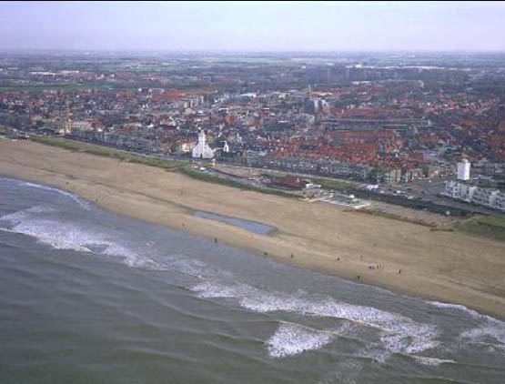
PHOTO OF THE SITE
 |
|
CASE STUDY
| Title | Holland Coast |
| National level | The Netherlands |
| Regional level | North Holland |
| Local level | Province of North and South Holland |
ABSTRACT
|
Physically speaking the Dutch coast exists of three parts. The Holland coast is the middle part of the Dutch coast and consists of a closed coast dune areas, varying in width from less than 100m to several kilometres. As a low-lying country, the Netherlands is very vulnerable for flooding. In the low-lying polders, behind the sea defence, 60% of the population is living and 65% of the national gross product is earned. The pressure on the coast increases, both from the sea and the land. The pressure from the sea increases because of the increasing sea level rise and the expected storm intensity. The pressure from the land increases as a result of the growing number of inhabitants and the intensification of the area use. In the coastal zone of the Holland coast a lot of socio-economic function come together. The area serves a key economic function, encompassing tourism, port industries, bulb growing, water abstraction activities and fisheries. Currents, waves, wind, sediment deposits from the rivers and human made structures have resulted in the present geomorphologic features of the coast. The Dutch coast is an erosive coast and there is a long tradition in coastal protection. In 1990, the Dutch Government decided that further loss of land to the sea was no longer acceptable any more, too many interest were at stake. The Ministry of Transport, Public Works and Water Management established the ‘basal coastline’ as the position of the coastline on the first of January 1990. The technique used is sand nourishment and can be described as soft were possible and hard were necessary. |
BASIC INFORMATION
| Coastal characteristics |
|
| Policy options | Hold the line |
| Socio-economic activities | Tourism, fisheries and ports |
| Engineering techniques | Nourishment, groyne |
SOURCE
| Name | Aline Arends |
| Institution | National Institute for Coastal and Marine Management-RIKZ |
| Address | PO
Box 20907 2500 EX The Hague |
| Telephone / fax | +31 70 311 43 59/ +31 70 311 43 00 |
| a.a.arends@riks.rws.minvenm.nl |