| Data
description |
This
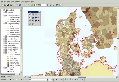
layer depicts European administrative units from the highest level (national
boundaries) to the lowest level (municipalities or equivalent), using
the Nomenclature of Territorial Units for Statistics (NUTS). NUTS is a
5-level classification established by EUROSTAT to provide a single uniform
breakdown of territorial units for the production of regional for the
European Union. NUTS 5 corresponds to the lowest level. |
| Source
of data |
Seamless
Administrative Boundaries of Europe (SABE) version 2.1 (1997). Distributed
by EuroGeographics. SABE is derived from cartographic data provided by
the national mapping agencies. |
| Geographical
restrictions |
SABE
v2.1 covers all European Union countries, as well as Estonia, Latvia,
Lituania, Poland, Slovenia. |
| Quality |
SABE
is derived from basic data which are of the best available semantic quality
and of the application scale the closest to 1: 50.000 for each country.
These basic data have been organised into a homogeneous structure and a
uniform reference system, line-filtered to a uniform resolution and are
edge matched at international boundaries (“seamless” polylines). |
| Copyright
and data access conditions |
The
dataset is copyrighted (EuroGeographics). Licence fees for accessing the
complete database is about 15,200 Euros, with the possibility to be purchased
country by country. A licence of SABE 97 has already been granted to the
European Commission, which makes this layer available free-of-charge for
any application internal to the European Commission. Its dissemination outside
the European Commission shall be subject to negotiation with EuroGeographics. |
