| Data
description |
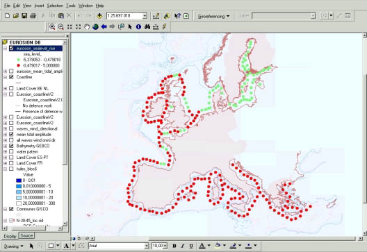
This
layer provides information on the relative sea level rise at 237 locations
along the European coastline. These locations are situated 50 to 100 km
away from the shoreline. Distance from one location to another location
is approximately 100 km (see also layer “wind and wave climate”) |
| Source
of data |
Relative
sea level rise (RSLR) at the 237 locations are extrapolated from the digitization
of two maps, namely :
- the map
by [Douglas et all, 2001] which provides an estimate of RSLR for the
whole of Europe
- the map
by [Lambeck et. al., 1997] which covers a smaller area in more detail,
i.e. the North Sea
|
| Geographical
restrictions |
No
data have been computed for the ultraperipheral regions and for Cyprus. |
| Quality |
Source
data have been severely checked and corrected with observation of tide gauges. |
| Copyright
and data access conditions |
As a EUROSION assignment, this layer is publicly available inside and outside
the European Commission. |