| Data
description |
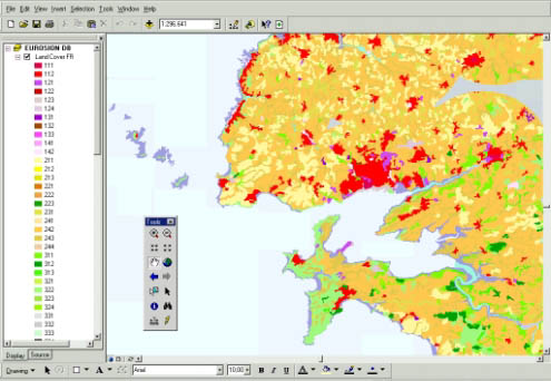
Data
contained in this layer are twofold:
- land
cover data provided in vector format (polygons) and at scale 1:100,000.
The minimum polygone size is 25 hectares. Land cover is organised in
44 different classes distributed into 5 categories (urbanised areas,
agricultural areas, natural and semi-natural areas, wetlands, and water
bodies) and with 3 levels of details
- land
cover changes since 1975 provided in vector format (polygons) and at
scale 1:100,000 as well. Land cover changes since 1975 only reports
which polygons had a change of their land cover type since 1975.
Data of this
layer are restricted to the 10 km land strip from the coastline |
| Source
of data |
Souces
of data on land cover and land cover changes are threefold :
- CORINE
Land Cover version 1990 provides data which result from a visual analysis
of LANDSAT and SPOT satellite images (mainly from 1987 to 1994) and
interpreted with the support of ancillary data (such as aerial photographs,
topographical maps, or ecological maps). The 44 classes nomenclature
of CORINE Land Cover (and therefore EUROSION) is standardized for all
Europe which makes comparison and aggregation at the European level
easier. Note that CORINE Land Cover version 2000 is under development
by the European Environment Agency.
- LaCoast
project. LaCoast is a research project undertaken in the mid 1990 under
the lead of the Joint Research Centre (JRC) and aimed at quantifying
the changes of land cover types in a 10 km land strip from the coastline.
LaCoast uses CORINE Land Cover version 1990 as its reference dataset
and track differences of land cover changes using LANDSAT satellite
images from the mid-1970’s .
- EUROSION
is extending the methodology of LaCoast to other European countries
not currently covered by LaCoast. The same methodology was used to ensure
consistency, easy comparison, and quick aggregation.
|
| Geographical
restrictions |
CORINE
Land Cover does not include at this stage validated data for Sweden (validation
in process), and no data at all for Malta and Cyprus. These countries
have therefore not been included in the EUROSION layer.
EUROSION is extending the current LaCoast database - with the same specifications
– to Poland, Baltic states, Romania, Bulgaria and Slovenia. United Kingdom,
Sweden, and Finland are not covered due to incompatibilities between CORINE
Land cover data in these countries and the LaCoast methodology. |
| Quality |
CORINE
Land Cover data have undergone several quality controls by the EEA. Geometrical
accuracy is relatively good however some inconsistencies exist at the border
between different countries (e.g. France and Belgium). The quality of LaCoast
data is currently being controlled by the JRC. Results will be shortly known.
As for the extension to accessing countries quality results look very satisfactory. |
| Copyright
and data access conditions |
CORINE Land cover data are accessible for free from the European Environment
Agency (EEA). LaCoast data have to be requested to the Joint Research Centre
(JRC). As for data extended by EUROSION, they will be freely accessible
upon request. |