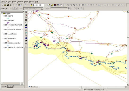
Infrastructure layer of GISCO provides information on main airports, harbours, terrestrial and maritime roads, settlements and industries in Europe. This screenshot is an excerpt from this layer in the region of Marseille and Toulon in France.
9. INFRASTRUCTURE
| Infrastructure layer of GISCO provides information on main airports, harbours, terrestrial and maritime roads, settlements and industries in Europe. This screenshot is an excerpt from this layer in the region of Marseille and Toulon in France. |
|
| Data description |
This layer provide a cartographic representation of European harbours, jetties, airports, railways, terrestrial and maritime roads, and industrial facilities, at scale 1:1,000,000 and in vector format. |
| Source of data |
The data included in this layer come from the Infrastructure layer of GISCO database distributed by EUROSTAT. No new data have been produced by EUROSION in relation with this layer. |
| Geographical |
The same as GISCO |
| Quality | No documentation available |
| Copyright and data access conditions | As data coming from GISCO, the use of this layer is subject to authorisation from EUROSTAT. |